Miami Case Study
Purpose: Provide geospatial information for the planning, implementation and assessment of nature based solutions to disaster mitigation in urban areas.
Target Users: Local resilience planners and implementing organizations.
Introduction
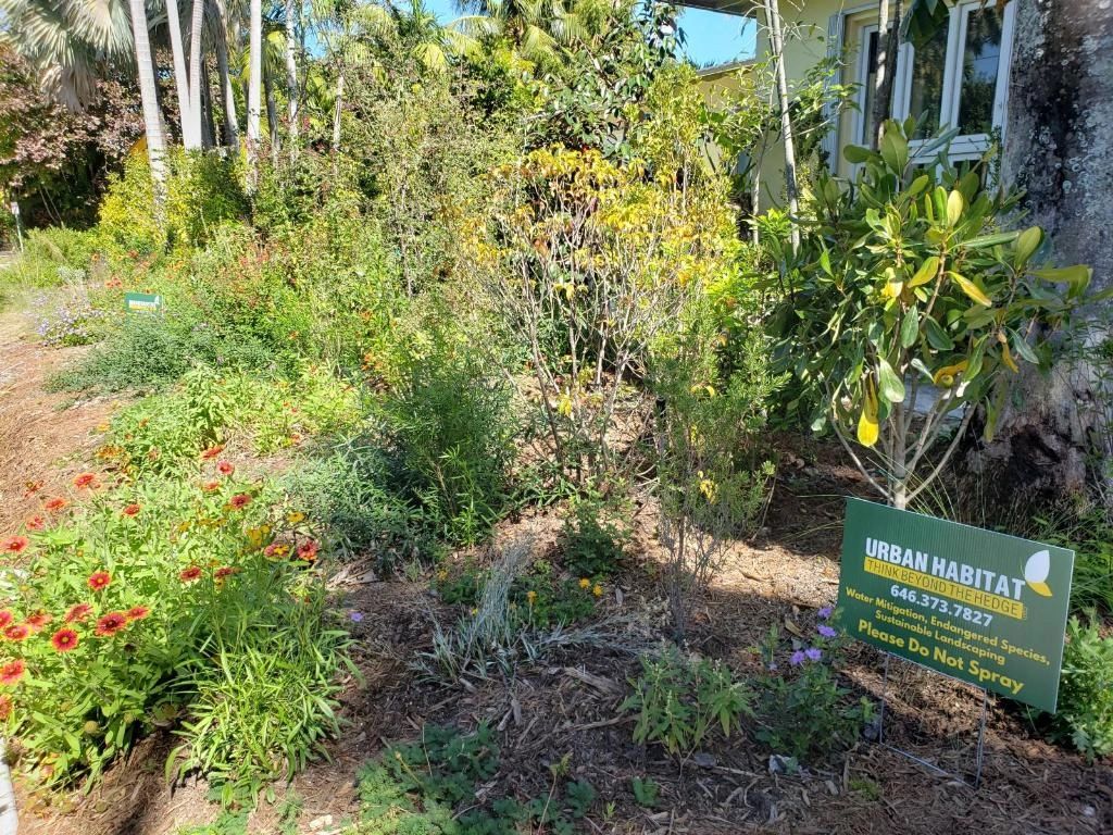
Our UrbanEcoTech project’s first case study in Miami-Dade County is designed to build a centralized home for geospatial information in the county which can be used to identify key locations for and map the implementation of nature based solutions to disaster mitigation, particularly urban forestry.
We chose to start with Miami-Dade because it’s our home county and one which is especially vulnerable to natural disasters. Within that scope we decided to begin with a focus on flooding because of the enormous risks and challenges it poses to the county, almost all of which is within FEMA flood zones.
We designed this initial project for FEMA’s 2022 TOP Sprint, the focus of which is to innovate around the development of data tools which help improve community resilience.
Process
Our process was to begin by indexing national, state, county and hyperlocal datasets significant to the implementation of nature based solutions and the mitigation of disasters.
For this Miami-Dade County case study we included datasets such as FEMA’s flood zones map, the state’s groundwater sensor network map and county maps such as public lands, impervious surfaces and stormwater infrastructure.
Hyperlocal sets collected by and within specific municipalities can then be added to this tool over time. As nature based solutions are implemented and as disasters affect the city the mitigative impact of those projects can then be mapped, studied and quantified.
Likewise, further layers can be added as their benefit to this research is assessed and desired.
Goals
The goal of this case study is to demonstrate the effectiveness of nature based solutions as disaster mitigation tools and support implementing organizations.
Our target end users of this tool are administrators engaging mitigation solutions and their data including county officials, university liaisons, nonprofit and corporate representatives, community organizations and citizen scientists.
We see this tool providing value to both local resilience planners and implementing organizations to plan, execute and assess solutions.
We believe that as the Miami-Dade County case study is further developed and put to use this same methodology could then be used to create these tools for other counties throughout the state and country.
Feedback
We would love to hear user feedback, especially if this is a tool you could see yourself interacting with in your work! We are very interested in hearing which use cases you could see yourself applying the tool to, what features would make it most effective for you, further layers which you could see providing valuable insight and any other recommendations you have for the tool.
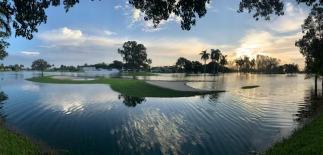
Hyperlocal Flooding Map
This map is derived from a citizen scientist weather and flood reporting platform available in Miami.
Learn more about the platform by checking out the ISeeChange section in the resources area below.
Citizens are encouraged to post occurances of flooding and weather anomalies with pictures and this information is relayed directly to city officials and technicians.
This hyperlocal data is crutial in determining areas where mitigation strategy implementation is necessary.
City of Miami Infrastructure Layers
Miami Dade County Contours
Combined Infrastructure Layers with Flooding Occurances Heatmap