The Problem:
Lack of data-driven systems to help cities create nature based solutions in impact areas and measure their effectiveness.
The Solution:
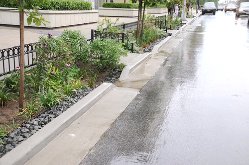
Use geospatial and weather data to identify areas of critical need, map the implementation of solutions and measure their results over time.
The purpose of UrbanEcoTech is to provide geospatial information for the planning, implementation and assessment of nature based solutions to weather mitigation in urban areas. The goal is to identify key locations for the implementation of nature based solutions to hazards caused by weather. These tools are designed to help implementing organizations design and track solutions on the one hand, and local resilience planners make decisions and determine their effectiveness over time on the other.
We take existing data on a city’s infrastructure and compile the most important layers with filters significant to the most important climate hazards affecting that environment.
We then add data tracking climate hazards in the city to identify the areas experiencing the effects most severely and evaluate why that is the case.
Then we use this system to evaluate where nature based solutions to these weather hazards can be implemented to make the most significant impact.
Once target areas are identified we work with local contractors and the cities to implement solutions in the most critical areas as cost effectively as possible.
Over time the same system is then used to measure the effectiveness of implemented solutions and identify new priority areas to target next.
Learn About UsOur systems are designed to serve local resilience planners as their comprehensive platform for
pursuing nature based solutions to climate hazards through an evidence based approach.
We integrate diverse sets of data to build a comprehensive understanding of the factors affecting each location.
Much of the data we use is local and hyperlocal to understand each unique case in full detail.
Our tools are designed to optimize the use of nature to respond to both the immediate hazards and root causes of climate change.
We work with local expertise at each stage of the development process, from data collection through solution implementation.
Both our systems and their end result solutions are designed to increase their impact over time.
Our tools are designed to measure the impact of the solutions implemented, allowing planners to continue to assess and adapt.
Our systems are designed to guide an evidence based approach and will improve over time with more data on the municipality and the solutions implemented.
Our solutions provide far reaching social benefits beyond their role in climate hazard mitigation as well.
Our systems are designed to fit each unique location that implements them.
Read more about the far reaching benefits of pursuing nature based solutions in urban planning through a local data driven evidence based approach.